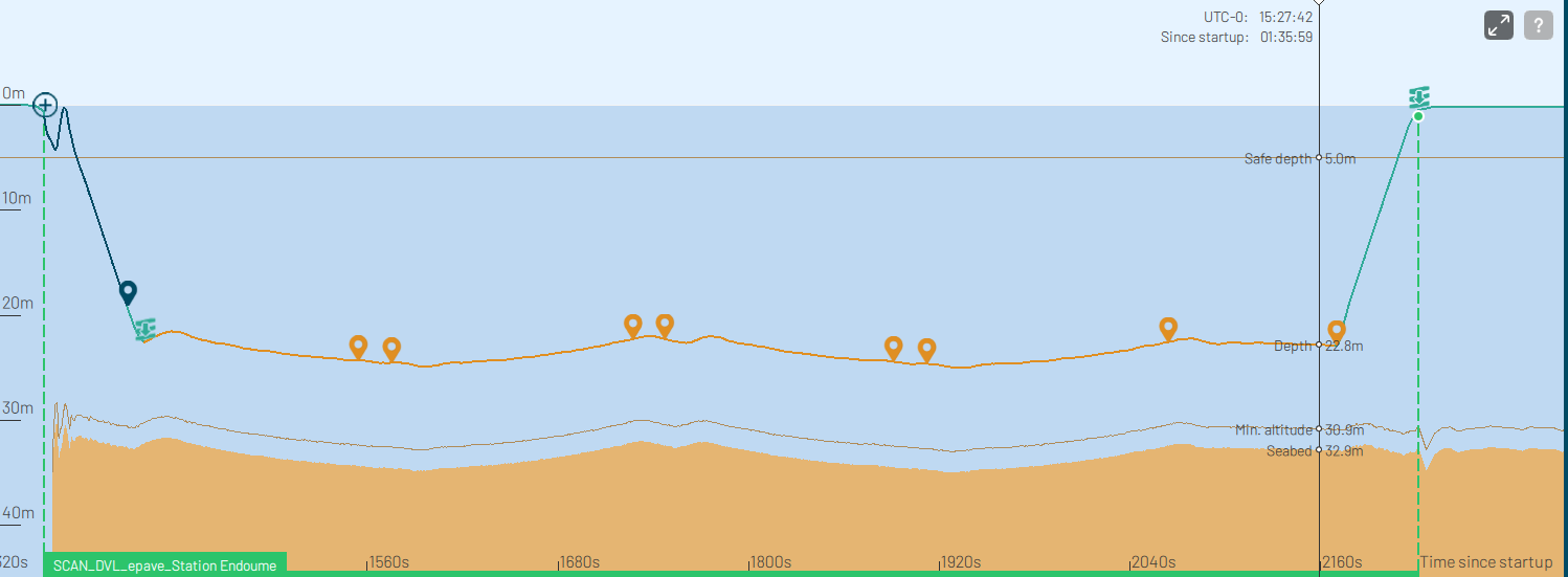
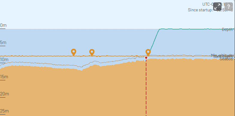
📉 Depth
Efficiently display AUV trajectory on the Depth View, analyze mission success promptly, and intuitively present altitude and depth information.
🧮 Calculate
Perform calculations in customizable fields such as bearing, distance or speed. Tailor it according to your needs.
⌨️ Navigate
Explore map navigation by utilizing keyboard arrows for movement and execute precise zoom controls using +/- or PgUp/PgDown keys.

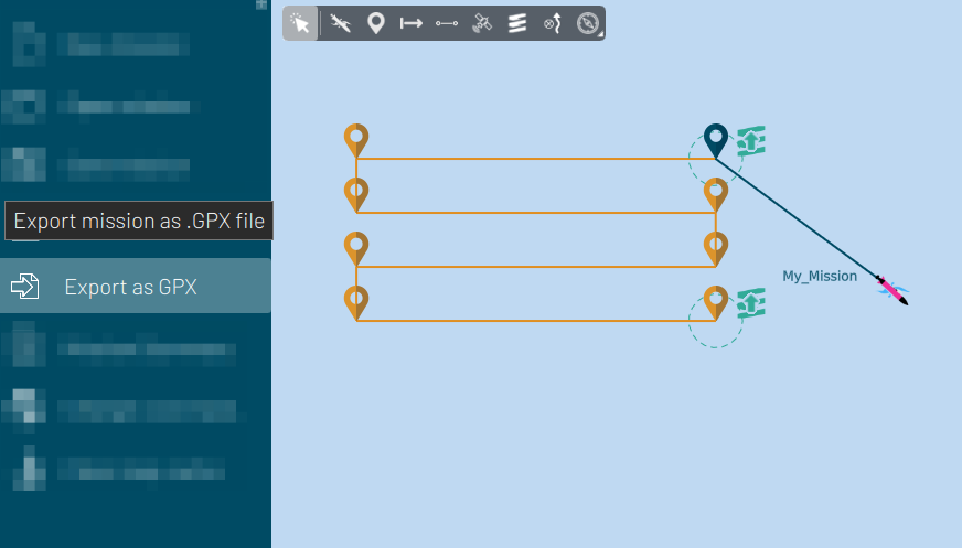
💾 Trajectory
Utilize the Export as GPX feature to seamlessly generate GPX files, facilitating the efficient transfer and sharing of your mission data
⬇️ Import
Add and edit GPX files, overlaying them with other missions for easier integration and enhanced mapping capabilities.

🧲 Calibration
Experience hassle-free magnetic calibration in water with the Automatic Calibration feature. Enhance accuracy and streamline the calibration process without manual intervention, ensuring optimal performance.
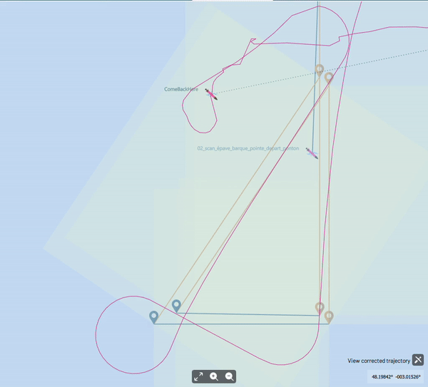
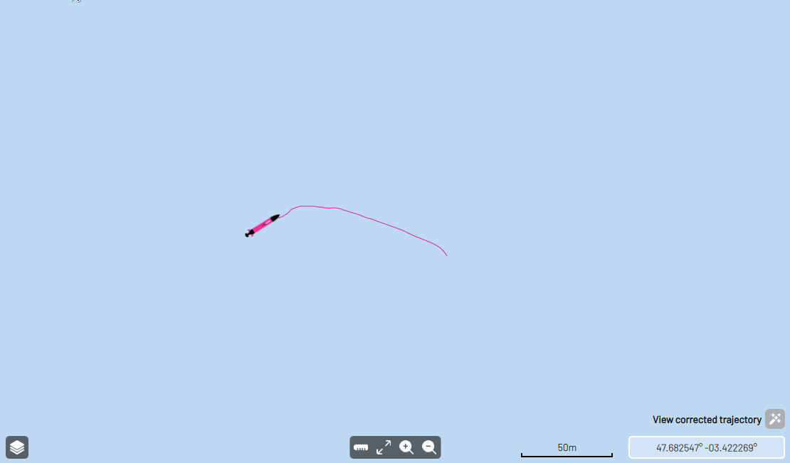
🖍️ Correction
Automated trajectory correction: Post-process AUV trajectory to adjust the localization deviations and improve precision.
📈 Altitude
Customize your navigation preferences according to your needs, easily selecting between navigating at a fixed depth or fixed altitude from seabed.
Additionally, personalize safety thresholds to safeguard your mission.

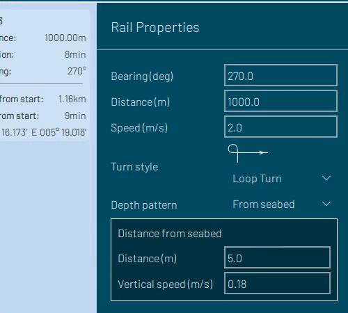
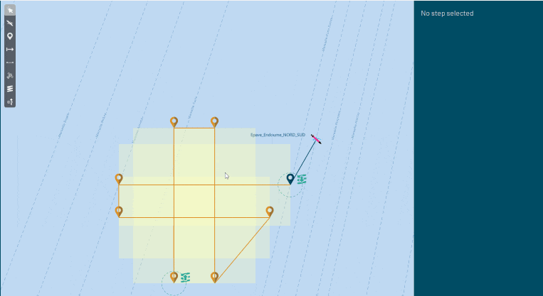
🎢 Patterns
We propose a variety of pre-defined survey patterns including sawtooth and screws, providing a significant advantage for oceanographic missions.
📃 Documentation
Access the always up-to-date user guide and feature details in the Documentation tab, along with the changelog for the latest updates description.

⚠️ Diagnose
In the event of a mission setback, the depth view not only offers valuable insights but also highlight the encountered issues for a comprehensive understanding.
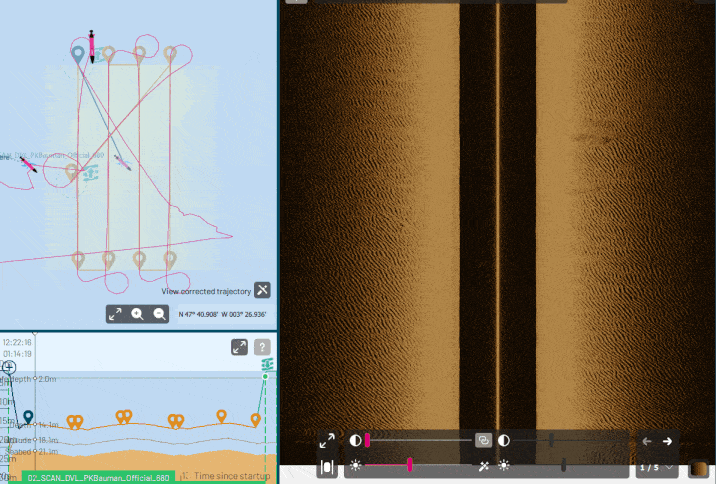
🔎 Preview
Instantly access YUCO-SCAN recordings and effortlessly navigate the waterfall view. Your cursor's movement provides real-time location updates across the depth view, map, and Side Scan Sonar images.
🚀 Speed
Automatic Speed Calibration fine-tunes the AUV's speed setpoint for enhanced performance.
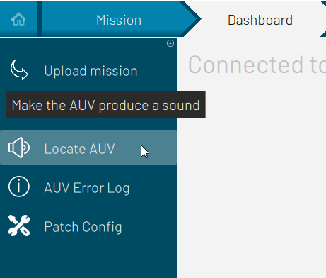
🕵️ Locate
Click Locate AUV to trigger a distinctive sound, effortlessly pinpointing the connected AUV. Handy with multiple YUCOs for accurate mission uploads!
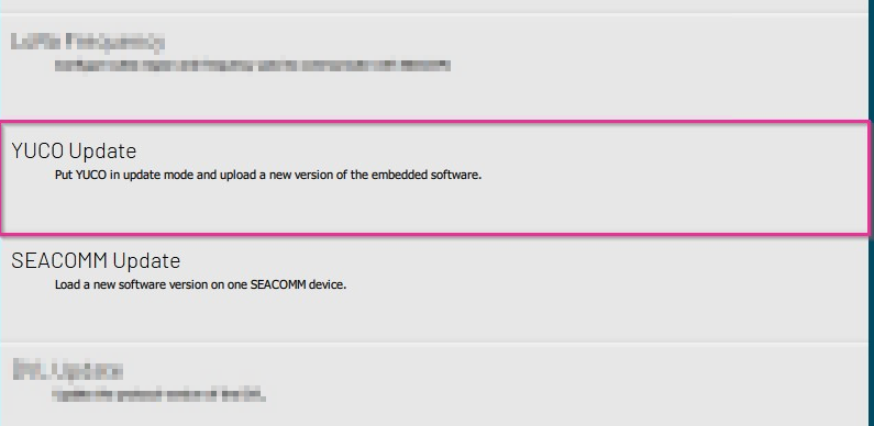
🆕 Update
Listening to your feedback, we constantly update and push the boundaries of our software to enhance and meet your evolving needs. Find the update procedure within the SEAPLAN software.
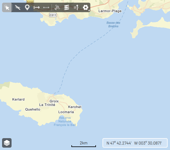
📍 Position
While connected to the AUV before launching, enjoy real-time tracking for visualizing the AUV position on the map, simplifying deployment.
🛰️ Coordinates
Copy and Paste coordinates from various software platforms into Seaplan. Effortlessly modify latitude and longitude coordinate formats.
📁 Export
Upon completing your mission and transferring YUCO data to SEAPLAN, you have the option to Export a .CSV file including all the navigation data from your AUV.

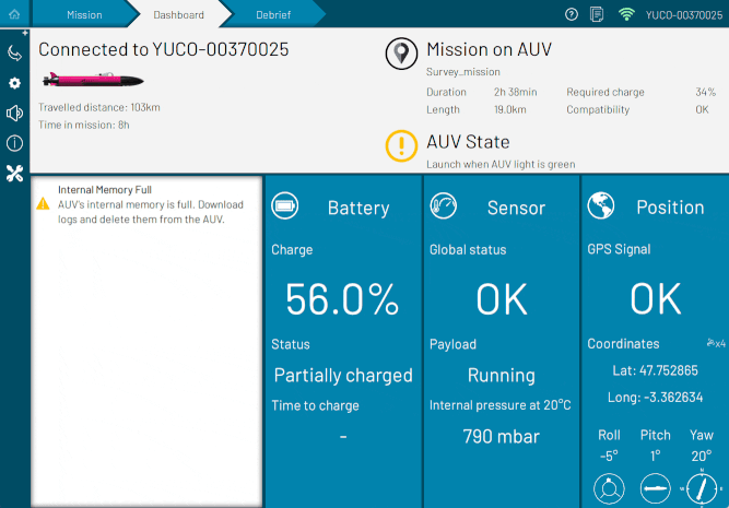
💻 Dashboard
The AUV dashboard grants quick access to AUV status, sensor state, and mission feasibility.
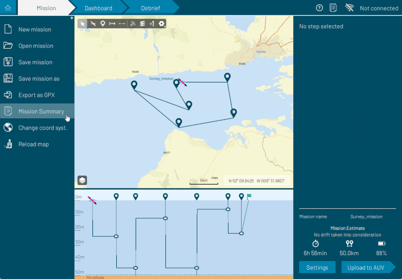
📋 Summary
Quickly access your mission summary, available as a PDF file, to obtain details on the AUV's planned navigation distance, timing, and autonomy information. This format makes it easy to share with crew members and collaborators.
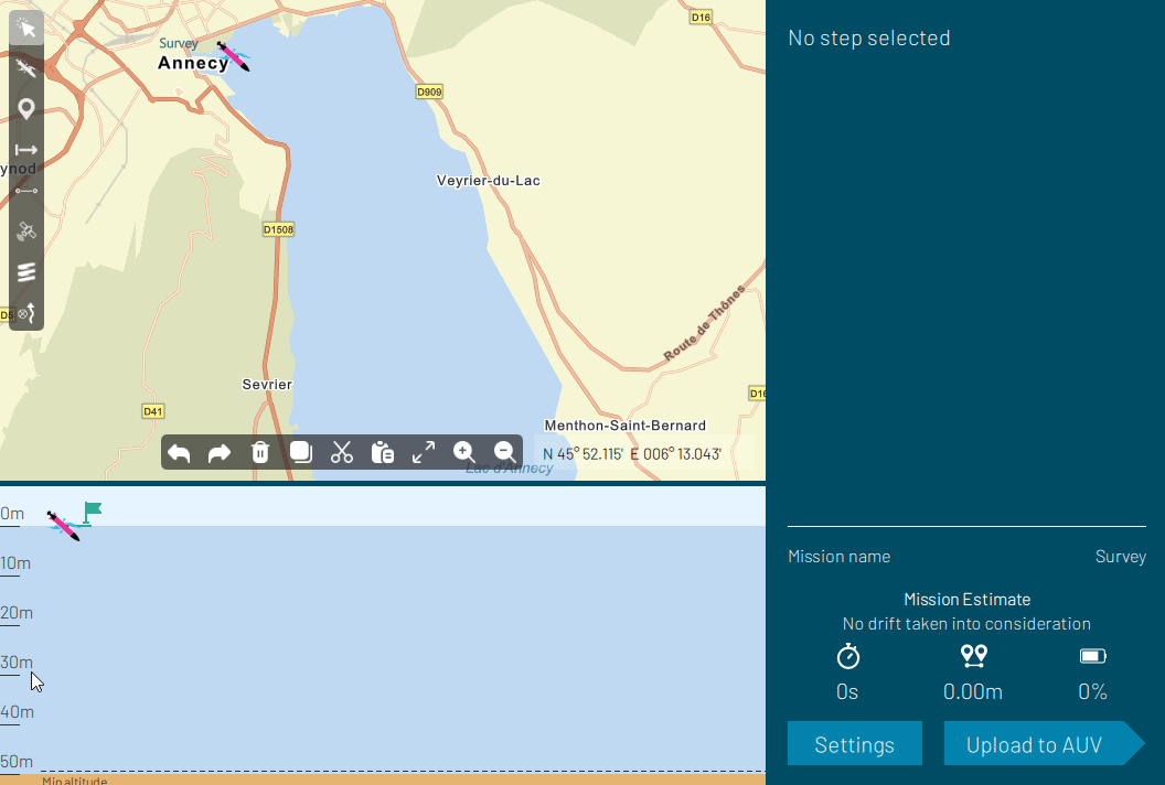
✏️ Edition
Edit multiple mission steps at once by selecting them (Ctrl or Shift click). Modify shared properties like speed and depth, and seamlessly move them around the map for effortless mission editing.
🗺️ Cartography
Elevate your Mission and Debrief views by importing your S57 nautical charts as layers.

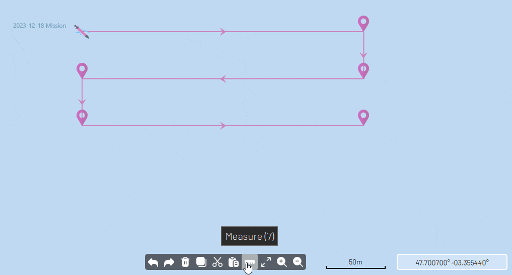
📏 Measure
Distance and measuring tool to easily get a sense of scale on both the Mission and Debrief maps.
🌐 Geotiff
Import your Geotiff files into the Mission and Debrief views to enhance your mission capabilities.
